|
FreeComputerBooks.com
Links to Free Computer, Mathematics, Technical Books all over the World
|
|
- Title: Google Earth Engine Applications
- Author(s) Lalit Kumar, Onisimo Mutanga
- Publisher: Mdpi AG (April 23, 2019)
- Paperback: 420 pages
- eBook: PDF (422 pages)
- Language: English
- ISBN-10: 3038978841
- ISBN-13: 978-3038978848
- Share This:

|
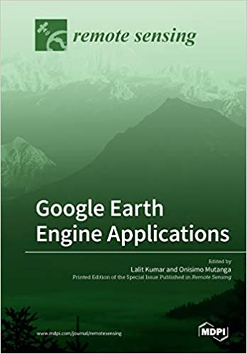
This book presents research that applies the Google Earth Engine in mining, storing, retrieving and processing spatial data for a variety of applications that include vegetation monitoring, cropland mapping, ecosystem assessment, and gross primary productivity, among others. Datasets used range from coarse spatial resolution data, such as MODIS, to medium resolution datasets (Worldview -2), and the studies cover the entire globe at varying spatial and temporal scales.
About the Authors- N/A

- Google Earth Engine Applications (Lalit Kumar, et al)
- The Mirror Site (1) - PDF
- The Mirror Site (2) - PDF
-
 Cloud-Based Remote Sensing with Google Earth Engine
This book guides its audience - which can range from novice users to experts - though a 55-chapter tour of Google Earth Engine to allow users with multiple experience levels to easily find an entry point.
-
 Google Maps API Tutorial (Mike Williams)
It will provide the reader with the skills and knowledge necessary to incorporate Google Maps version 3 on web pages in both desktop and mobile browsers..
-
 Google Maps API Succinctly (Mark Lewin)
It gives you a hands-on, beginner-level introduction to developing mapping applications using the Google Maps JavaScript API. Learn the ins and outs of the API so that you can harness the power of Google Maps within your own websites and applications.
-
 Leaflet.js Succinctly: An Introduction to Web Mapping (Mark Lewin)
This introduction to Leaflet.js will teach key concepts of the software and critical techniques in order to help you develop web-ready interactive maps. It is the first step on the road to producing the best interactive maps you possibly can.
-
 Leaflet Tips and Tricks: Interactive Maps with leaflet.js
This book will help you learn how to create maps with the Leaflet JavaScript library (leaflet.js) through a series of step-by-step recipes to achieve great dynamic and interactive slippy maps..
-
 Bing Maps V8 Succinctly (James McCaffrey)
This book takes readers through utilizing Bing Maps API V8 JavaScript library, from creating the simplest application that uses it, to mastering more advanced functions like creating color-gradient legends and custom-styled Infobox objects.
-
 Map Scripting 101: Building Interactive Maps (DuVander)
This book delivers 73 immediately useful scripts that will show you how to create interactive maps and mashups.
-
 Geocomputation with R (Robin Lovelace, et al.)
This book is for people who want to analyze, visualize and model geographic data with open source software. It is based on R, a statistical programming language that has powerful data processing, visualization, and geospatial capabilities.
-
 Nature of Geographic Information Systems (David DiBiase)
The purpose of this book is to promote understanding of the Geographic Information Science and Technology enterprise (GIS&T, also known as 'geospatial'). It explores the nature of geographic information.
-
 An Introductory Textbook on Geographic Information Systems
This textbook is an introduction to GIS, but most of the chapter's concepts are also applicable to other geotechnologies including remote sensing, global positioning systems (GPS), Internet mapping, and virtual globes.
-
 Geographic Information System Basics (Jonathan Campbell)
From the melting of the polar ice caps to privacy issues associated with mapping, this book provides a gentle, yet substantive, introduction to the use and application of digital maps, mapping, and GIS.
-
 Principles of Geographic Information Systems (GIS)
This book is designed to provide students in a first or second GIS course with a solid foundation in both GIS concepts and the use of GIS. It strikes a careful balance between GIS concepts and hands-on applications.


