|
FreeComputerBooks.com
Links to Free Computer, Mathematics, Technical Books all over the World
|
|
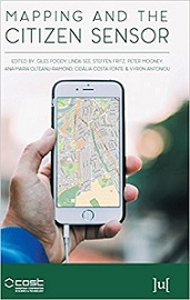
- Title: Mapping and the Citizen Sensor
- Author(s) Giles Foody (Editor), Linda See (Editor), Steffen Fritz (Editor)
- Publisher: Ubiquity Press (September 11, 2017); eBook (Creative Commons Licensed)
- License(s): CC BY-NC-SA 4.0
- Hardcover: 400 pages
- eBook: PDF (400 pages)
- Language: English
- ISBN-10: 1911529161
- ISBN-13: 978-1911529163
- Share This:

|
Maps are a fundamental resource in a diverse array of applications ranging from everyday activities, such as route planning through the legal demarcation of space to scientific studies, such as those seeking to understand biodiversity and inform the design of nature reserves for species conservation. For a map to have value, it should provide an accurate and timely representation of the phenomenon depicted and this can be a challenge in a dynamic world.
Fortunately, mapping activities have benefitted greatly from recent advances in geoinformation technologies. Satellite remote sensing, for example, now offers unparalleled data acquisition and authoritative mapping agencies have developed systems for the routine production of maps in accordance with strict standards.
This book explores issues linked to topics ranging from citizen motivation, data acquisition, data quality and the use of citizen derived data in the production of maps that rival, and sometimes surpass, maps arising from authoritative agencies.
About the Authors- N/A
- Geographic Information System (GIS) and Web Mapping
- Computer Graphics, 3D, Animation and Imaging
- Data Analysis and Data Mining, Big Data
- Statistics and SAS Programming

- Mapping and the Citizen Sensor (Giles Foody, et al)
- The Mirror Site (1) - PDF
- The Mirror Site (2) - PDF Files
-
 The Cognitive Life of Maps (Roberto Casati)
The “mapness of maps” - how maps live in interaction with their users, and what this tells us about what they are and how they work. Charting the way to a new understanding of what maps mean.
-
 Mapping, Society, and Technology (Steven Manson)
It is about how to read, use, and create maps. Our exploration of maps will be informed by a contextual understanding of how maps reflect the relationship between society and technology, and how mapping is an essential form of scientific and artistic inquiry.
-
 Shifts in Mapping: Maps as a Tool of Knowledge (C. Schranz)
Depicting the world, territory, and geopolitical realities involves a high degree of interpretation and imagination. Cartography originated in ancient times to represent the world and to enable circulation, communication, and economic exchange.
-
 GIS in Sustainable Urban Planning and Management
GIS is used today to better understand and solve urban problems. This book explores and illustrates the capacity that geo-information and GIS have to inform practitioners and other participants in the processes of the planning and management of urban regions.
-
 Cartography - A Tool for Spatial Analysis (Carlos Bateira)
This book presents several contributions at different areas and activities showing the importance of the Cartography to the perception and organization of the territory, showing the importance of the cartography to the perception and organization of the territory.
-
 Cartography and Map Design ( Carlos Bateira)
This book is an inspiring and creative companion along the nonlinear journey toward making a great map. It provides sound, visually compelling information that translates into practical and useful tools for modern mapmaking.
-
 Advanced Location-Based Technologies and Services
The book provides information on Location-Based Services (LBSs), including WiFi fingerprinting, geo-crowdsouring, and location privacy as well as application areas such as LBSs for public health, indoor navigation, pedestrian navigation, and advertising.
-
 Archaeological 3D GIS (Nicolò Dell'Unto, et al.)
This book provides archaeologists with a guide to explore and understand the unprecedented opportunities for collecting, visualising, and analysing archaeological datasets in three dimensions, using GIS.
-
 Linked Data: A Geographic Perspective (Glen Hart, et al)
Combine Geographic Information from Multiple Sources Using Linked Data - A Practical, Readable Guide for Geographers, Software Engineers, and Laypersons. Organize and describe data that includes geographic content and publish it as Linked Data.
-
 Earth, Space, Environmental Science Explorations with ArcGIS Pro
This book covers a range of topics in the earth and space sciences, such as plate tectonics, natural hazards, Mars exploration, and climate change. Through a series of hands-on exercises, readers will gain basic competency in Esri's ArcGIS Pro software.


