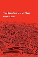
|
FreeComputerBooks.com
Links to Free Computer, Mathematics, Technical Books all over the World
|
|
- Title: The Cognitive Life of Maps
- Author(s) Roberto Casati
- Publisher: The MIT Press (May 14, 2024); eBook (Creative Commons Licensed)
- License(s): Creative Commons License (CC)
- Hardcover: 256 pages
- eBook: PDF and PDF Files
- Language: English
- ISBN-10: 0262547082
- ISBN-13: 978-0262547086
- Share This:

|
The “mapness of maps” - how maps live in interaction with their users, and what this tells us about what they are and how they work.
From the mechanics of maps used for navigation to the differences and similarities between maps and pictures and models, this is a cognitive map in its own right, charting the way to a new understanding of what maps mean.
About the Authors- Roberto Casati is Director of the Jean Nicod Institute and Professor at EHESS (School of Advanced Studies in the Social Sciences) in Paris.
- Geographic Information System (GIS) and Web Mapping
- Computer Graphics, 3D, Animation and Imaging
- Data Analysis and Data Mining, Big Data
- Statistics and SAS Programming
 Similar Books:
-
 Mapping Landscapes in Transformation: Historical Analysis
The development of Historical Geographical Information Systems (HGIS) and other methods from the digital humanities have revolutionised historical research on cultural landscapes. The aim is to advance cartographic practices.
-
 Mapping and the Citizen Sensor (Giles Foody, et al)
The proliferation of inexpensive and highly mobile and location aware devices together with Web 2.0 technology have fostered the emergence of the citizen as a source of data. Mapping activities have benefitted greatly from advances in geoinformation technologies.
-
 Mapping, Society, and Technology (Steven Manson)
It is about how to read, use, and create maps. Our exploration of maps will be informed by a contextual understanding of how maps reflect the relationship between society and technology, and how mapping is an essential form of scientific and artistic inquiry.
-
 Shifts in Mapping: Maps as a Tool of Knowledge (C. Schranz)
Depicting the world, territory, and geopolitical realities involves a high degree of interpretation and imagination. Cartography originated in ancient times to represent the world and to enable circulation, communication, and economic exchange.
-
 GIS in Sustainable Urban Planning and Management
GIS is used today to better understand and solve urban problems. This book explores and illustrates the capacity that geo-information and GIS have to inform practitioners and other participants in the processes of the planning and management of urban regions.
-
 Advanced Location-Based Technologies and Services
The book provides information on Location-Based Services (LBSs), including WiFi fingerprinting, geo-crowdsouring, and location privacy as well as application areas such as LBSs for public health, indoor navigation, pedestrian navigation, and advertising.
-
 Cartography - A Tool for Spatial Analysis (Carlos Bateira)
This book presents several contributions at different areas and activities showing the importance of the Cartography to the perception and organization of the territory, showing the importance of the cartography to the perception and organization of the territory.
-
 Cartography and Map Design ( Carlos Bateira)
This book is an inspiring and creative companion along the nonlinear journey toward making a great map. It provides sound, visually compelling information that translates into practical and useful tools for modern mapmaking.
-
 How to Read Geological Maps (Robert Davidson)
A general introduction with to maps, security, topographic map symbols, grids, the use of overlays, aerial photographs, land navigation, use of compass, orienteering, etc. . Very well illustrated, you are lost without it.
-
 Linked Data: A Geographic Perspective (Glen Hart, et al)
Combine Geographic Information from Multiple Sources Using Linked Data - A Practical, Readable Guide for Geographers, Software Engineers, and Laypersons. Organize and describe data that includes geographic content and publish it as Linked Data.
-
 Earth, Space, Environmental Science Explorations with ArcGIS Pro
This book covers a range of topics in the earth and space sciences, such as plate tectonics, natural hazards, Mars exploration, and climate change. Through a series of hands-on exercises, readers will gain basic competency in Esri's ArcGIS Pro software.


